The Vinland Map: A Famous Forgery in the History of Paper
News News blog
The Vinland Map was long considered a sensation: It was supposed to prove that Vikings discovered America even before Columbus. But in 2021, researchers at Yale University definitively exposed the map as a forgery. The story of this map impressively demonstrates how important the analysis of paper and ink is for verifying the authenticity of historical documents.
What Is the Vinland Map?
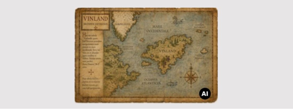
The Vinland Map is a world map purportedly dating from the 15th century. In addition to Europe, Asia, and Africa, it shows three islands in the North Atlantic: Iceland, Greenland, and an island named “Vinland” west of Greenland. The map bears the inscription “Vinilanda Insula a Byarno reperta et leipho sociis”—“The island of Vinland, discovered by Bjarni and his companions Leif.”
A longer text on the map describes how the Vikings Bjarni Herjólfsson and Leif Eriksson discovered a new, fertile land. The map also mentions a Bishop Henricus, who traveled to Vinland last year at the behest of Pope Paschalis II.
The Historical Significance
If the map had been genuine, it would have proven two things: First, that the Vikings actually reached America. Second, that this was already known in the 15th century—long before Columbus’s voyage in 1492. In fact, it wasn’t until 1960 that archaeologists discovered a Viking settlement dating from between 990 and 1050 at L’Anse aux Meadows in Newfoundland. These findings confirmed the Old Norse sagas independently of the map.
The Road to Debunking
The map surfaced in 1957 at the shop of dealer Enzo Ferrajoli de Ry, who was later convicted of receiving stolen goods. An antiquarian from Connecticut purchased it, along with a medieval manuscript, for $3,500. In 1959, it was acquired by Yale University for $250,000.
Doubts about its authenticity arose immediately. Experts pointed out several inconsistencies: The depiction of Vinland was unusually detailed. The map appeared to be organized like modern cartographic works. Greenland was shown as an island—a fact that had not been known until the 19th century.
The Decisive Evidence: The Ink
The parchment itself is genuine and has been verifiably dated to the 15th century. Radiocarbon dating placed it around 1434. But the ink gave away the forgery. Scientists at Yale University analyzed the ink using state-of-the-art methods. The result was clear: The ink contains titanium dioxide in a form that has only been produced since 1923. Furthermore, the ink lacks iron and sulfur—components that would necessarily be present in medieval iron gall ink.
In 2018, further analyses showed that the morphology and size of the anatase particles (a form of titanium dioxide) correspond to those found in modern ink. The researchers concluded that this was a deliberate forgery, not a harmless prank.
The Intent to Deceive
Particularly clever: The forger wrote over an authentic bookbinder’s note on the back of the parchment with his modern ink. This was intended to make an examination suggest that the inscription and the map were written with the same ink—and thus dated from the same period.
What Remains?
The forger’s identity is unknown. Historian Kirsten A. Seaver suspects the German cartographer Joseph Fischer, but this theory is largely rejected.
Nevertheless, the Vinland Map remains in the Yale University Library. Scholars regard it as a historical artifact—an outstanding example of a forgery with global impact. It impressively demonstrates how modern analytical techniques for examining paper and ink can solve historical mysteries.